геология и разведка
Preview

Proceedings of higher educational establishments. Geology and Exploration

Advanced search

«Proceedings of higher educational establishments. Geology and Exploration»

The publishing of a series of «Proceedings of higher educational establishments», including the journal «Geologiya i Razvedka» was originated in accordance with the Decree of the Ministry of Higher Education of the USSR on July 31, 1957. The first issue of  «Proceedings of higher educational establishments. Geology and Exploration» was published in January 1958.

Since September 18, 2014 the founder and publisher of the Journal is the Sergo Ordzhonikidze Russian State University for Geological Prospecting, Sergo Ordzhonikidze Geo University, MGRI.

Certificate of registration of Mass Media ПИ №ФС №59165 from 18.09.2014.

The Journal is issued 4 times per year; printing format 60ˣ90/8, volume of 10–12 quires. The Journal has a contemporary design, and meets the requirements of the international standards. The Journal has18 sections for various fields of the Earth science and actual problems of the industry: geology; mineralogy, petrography, lithology; useful minerals, methods of their prospecting and exploration; hydrogeology and engineering geology; geophysical methods of prospecting and exploration; geological exploration technique; discussions; mineral and geological exploration economics; legal issues in mineral resources exploitation; geoecology; geoinformatics; from the history of science; geologic education issues; brief reports; critics and bibliography; chronics; the museum’s showcase.

The Journal issues the articles which present the results of theoretical and experimental studies carried out at the universities and research institutions, exploration companies, as well as the personal initiative of the authors. The Journal publishes the review articles covering the current state of actual problems of geological science and mineral resources exploration practice, materials of conferences, workshops and meetings. The Journal promotes the advanced industrial and production experience. More than 14500 articles were published in the Journals since its foundation.

During more than 60 years of its existence the Journal «Izvestiya Vysshikh Uchebnykh Zavedeniy. Geologiya i Razvedka» has established itself as one of the leading and reputable scientific periodicals of the country in the field of Earth sciences. The Journal effectively participates in solving of scientific and technical problems, promoting the latest progresses and strengthens the authority of university and industry research in geology. It helps to improve the preparation of highly qualified engineers, scientists and teachers.

The Journal is included into the «List of leading reviewed scientific journals, where the main results of Dissertations for the degree of Doctor and Doctoral Candidate of Sciences should be published» by the Higher Attestation Commission (VAK) of the Ministry of Education and Science of the Russian Federation.

All articles submitted to the journal are reviewed by highly qualified specialists from both the editorial board and the leading institutions, academic and industrial organizations.

On April 19, 2007, for the 50th anniversary of the Journal the Russian Academy of Natural Science awarded the Journal «Proceedings of higher educational establishments. Geology and Exploration» with a high public non-state award – Order «For Merit to the Fatherland» named after V.N. Tatischev.

The Journal publishes the advertisements and communications relating to new developments and technology, publications in the fields of geology, exploration and mining.

Since January 2003 the journal «Proceedings of higher educational establishments. Geology and Exploration» is in open public access in the Scientific Electronic Library  elibrary.ru.

The Journal is included into the GeoRef database established by the American Geosciences Institute - GeoRef  (American Geosciences Institute ) and databases: CA(pt) (CAS), VINITI RAN,  Cyberleninka. The Journal is indexed in Google Scholar.

The Journal is included in the registry «Rospechat» (index 70366).

«Proceedings of higher educational establishments. Geology and Exploration» look forward to the fruitful cooperation with all members of the MGRI-RSGPU team, members of the other institutions, academic and industrial organizations in the field of earth sciences for the benefit of our country.

Current issue

Vol 68, No 1 (2026)
View or download the full issue PDF (Russian)

GEOLOGY

8-18 95
Abstract

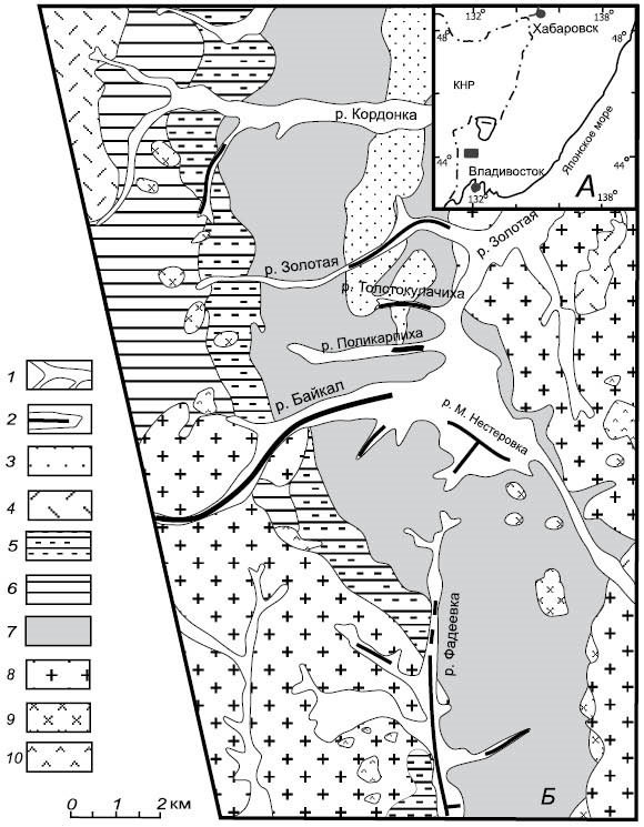
Background. The Fadeevsky ore-placer cluster (Primorsky Krai) is a promising gold-bearing area; however, the bedrock sources of its numerous placers remain a subject of debate. For the first time, a comprehensive microprobe study of the composition of native gold and its associated heavy fraction minerals has been conducted on the Malaya Nesterovka River placer, located within this cluster.

Aim. To perform a mineralogical and geochemical study of native gold and accessory minerals in the magnetic, electromagnetic, and heavy fractions of the Malaya Nesterovka placer using microprobe analysis and scanning electron microscopy for reconstructing potential types of primary source rocks and assessing subsequent post-sedimentary (supergene) processes within the placer system.

Materials and methods. Samples of natural concentrates were studied. Preliminary mineralogical inspection was carried out using MBS-10 and Nikon SMZ 465 binocular microscopes. For a detailed microchemical research, individual grains of gold and accessory minerals were selected and analyzed by scanning electron microscopy with energy-dispersive spectroscopy (SEM-EDS). The analyses were performed at the Center for Collective Use of the Far East Geological Institute FEB RAS using a Jeol JXA-8100 electron probe microanalyzer (Japan) and a Carl Zeiss EVO 50 XVP scanning electron microscope (Germany) equipped with an INCA Energy 350 spectrometer.

Results. The concentrates were found to have a complex polymictic composition. Four geochemical types of native gold were identified: high-fineness, uranium-rubidium-bearing, mercury-bearing,  and carbonaceous/organomineral-coated gold. Heavy mineral concentrates yielded platinum- group minerals (sperrylite), high-chromium spinels (Cr# = 0.95–0.99), ferrian baddeleyite, sulfides (bornite, pyrrhotite), and supergene Cr-M n-Si formations. The surface of gold particles was established to be susceptible to sorption of organic matter and clay minerals forming organomineral films containing up to 14.5 and 12.7 wt % of C and O, respectively.

Conclusion. As a result of the paragenetic analysis, a heterogeneous/diverse model of placer source rocks was proposed, including: (1) ultramafic-mafic massif (source of sperrylite, chromite, and baddeleyite); (2) mesothermal gold-quartz formation; (3) low-temperature gold-mercury mineralization; and (4) specialized gold-uranium-rare metal mineralization. The preservation of chemically unstable sulfides indicates the proximity of primary source rocks. Mineralogical and geochemical criteria for predicting concealed mineralization within the Fadeevsky Ore Cluster were developed.

19-31 90
Abstract

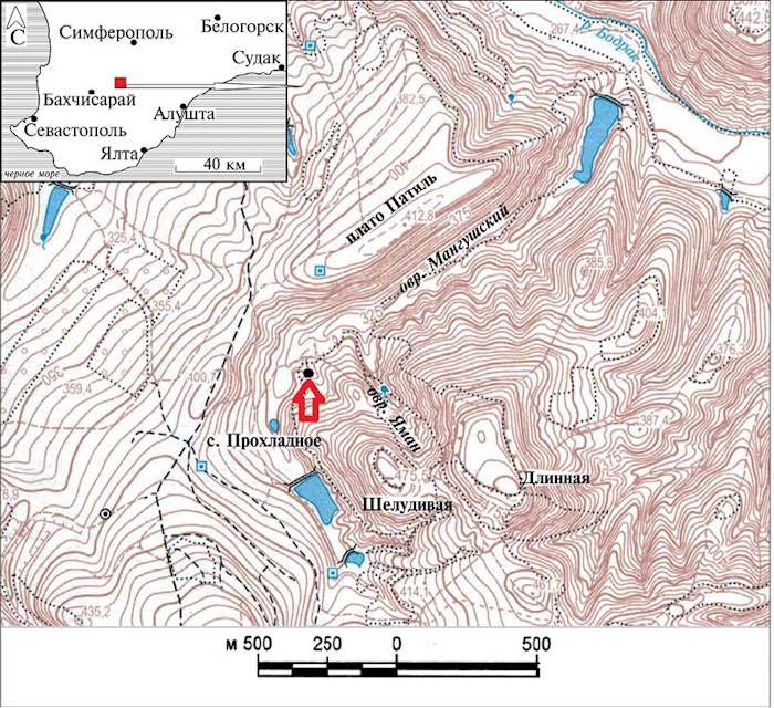
Background. The rocks of the Taurican series, which form the folded basement of the Crimean Mountains, are the most ancient stratified deposits in the mountainous Crimea. Their study has spanned over 230 years. The Taurican series is known for very rare fossils. New ammonite findings are essential for clarifying the relative age and detailed correlation of deposits.

Aim. To study the early Toarcian specimen of Peronoceras (Dactylioceratidae), newly found in Crimea.

Materials and methods. The specimen is an incomplete, deformed imprint containing a part of the shell core of a young Peronoceras sp. ind. Its preparation was performed mechanically; photography and processing of results were carried out using digital technologies. Before photography, the specimen was sprayed with ammonium chloride.

Results. The Lower Toarcian specimen of Peronoceras newly found in Crimea was studied in detail. The biostratigraphic significance of this finding was shown.

Conclusions. The Crimean specimen is possibly related to Peronoceras subarmatum (Young et Bird, 1822) with regular, widely spaced coarse ribs and fibulation already present on the inner whorls. Crimean strata containing Peronoceras sp. presumably occupy a higher position than those containing Dactylioceras cf. athleticum (Simpson, 1855), which is consistent with the biostratigraphic structure of the classic Toarcian section of Great Britain.

GEOLOGY AND PROSPECTING FOR SOLID MINERAL DEPOSITS
32-49 80
Abstract

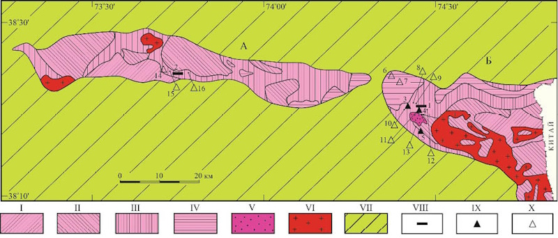
Background. the genetic features of transparent scapolite of the muzkol metamorphic series (Pr1), Central Pamir, are studied. The geological position of its deposits and occurrences is confined to albitites and granite pegmatites of the Sarydzhilga formation. Albitites with cavities containing transparent scapolite are represented by the Chernogorskoe industrial deposit and the Sirenevoe small deposit. Granite pegmatites with miarolitic cavities containing transparent scapolite are represented by Ledensi, Perevalnoe, and Verkhnee (with an uncertain industrial potential) occurrences. The genetic features of albitites and granite pegmatites with transparent scapolite are considered. The chemical features of transparent scapolite in both albitites (from 5 to 18 % of meionite minal) and granite pegmatites (from 21 to 29 % of meionite minal) were determined. These differences are also reflected in the IR spectra of scapolite samples in the range of 700–800 cm-1. Two generations of scapolite — hydrothermal-m etasomatic and hydrothermal — were established in albitites and granitic pegmatites. The scapolite of the latter generation was shown to exhibit the highest potential for jewelry application. The source of the fluid substance (Na, Cl, etc.) that caused the crystallization of scapolite was the marbles of the Sarydzhilga formation, i. e., proto-euporite formations. The formation of transparent scapolite is associated with the regressive stage of zonal metamorphism.

Objectives. (1) To establish the geological structure of mineralization areas with transparent scapolite. (2) To determine the chemical composition of transparent scapolite by X-ray spectral local microanalysis and IR spectroscopy. (3) To review the authors’ and literature data on fluid inclusions. (4) to identify the genetic features of transparent scapolite from the rocks of the muzkol metamorphic series.

Materials and methods. Samples for the study were collected during fieldwork in 2018, 2021, and 2022. In total, 10 scapolite crystals were studied. The chemical composition was examined by X-ray spectral microanalysis using an JCXA-733 device by JEOL using a Si(Li)-energy dispersive spectrometer and an INCA Energy 350 system (Oxford Instruments) at an accelerating voltage of U = 20 kV and a probe current of I = 1 nA (analyst L. A. Pautov, Fersman Mineralogical Museum of the Russian Academy of Sciences).

Results. a location map of scapolite deposits and occurrences and a geological plan of the chernogorskoye deposit were compiled. The chemical compositions of scapolite contained in albitites and granite pegmatites were determined. Fluid inclusions in scapolite samples were analyzed. The IR spectroscopy of jewelry-level scapolite was carried out. The genetic features of transparent scapolite from the Muzkol-R angkul anticlinorium were established.

Conclusion. Two generations of scapolite were identified in albitites and granite pegmatites of the Muzkol metamorphic series. The first was formed at a temperature of 580–450 °C and a pressure of 370–130 MPa; the second — at a temperature of 400–200 °C and a pressure of about 75 MPa. Scapolite samples from albitites and granitic pegmatites differ in chemical composition and IR spectra. Jewelry-level scapolite in albitites and granite pegmatites is characterized by the meionite minal content of 5–18 % and 21–29 %, respectively. The analysis of the IR spectra of scapolite samples at a wavelength of 700–800 cm-1 showed that the wave numbers of the absorption bands and the ratio of their intensities can be considered as typomorphic properties of transparent scapolite. The formation of transparent scapolite is largely associated with the composition of mineral-f orming solutions and gases, manifested in fluid inclusions represented by chloride brines, as well as liquid and gaseous cO2. Their source was the carbonate rocks of the Sarydzhilga formation, for which proto-evaporite sedimentation was typical.

50-62 110
Abstract

Background. The Cordillera del Condor in southeastern Ecuador hosts several gold deposits, including the Tunantza epithermal gold deposit and unexplored prospects. Furthermore, the relationship between physical properties and hydrothermal alteration assemblages as well as gold mineralization remains poorly studied, which can limit the interpretation of geophysical exploration data in this region. For the first time, this study presents the results of the analysis of selected physical properties of samples from the Tunantza deposit.

Aim. To evaluate the physical properties of rocks from the Tunantza gold deposit, establish their relationships with metasomatic facies, and identify mineralization zones.

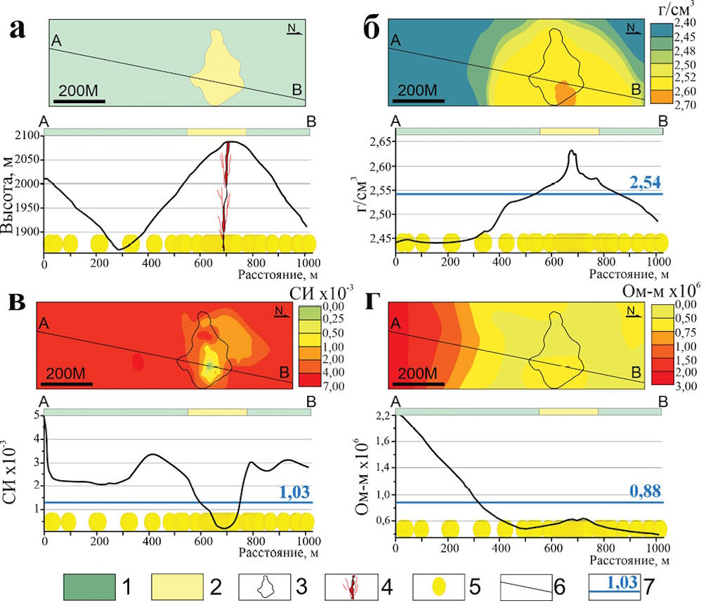
Materials and methods. Geological materials and data obtained from the documentation of surface outcrops and underground workings were used. Petrographic analysis was carried out on 96 thin sections (86 standard and 10 polished sections). In total, 315 samples were analyzed to determine density, magnetic susceptibility, and specific electrical resistivity. Spatial interpolation was performed using the kriging method in QGIS.

Results. The influence of metasomatism and the presence of the ore body on physical properties is manifested by an increase in density and a marked decrease in magnetic susceptibility from the propylitic zone toward the ore body. Interpolation models indicate that the ore zone forms as a composite anomaly characterized by high density and low magnetic susceptibility, surrounded by a conductive halo and an external magnetic halo.

Conclusion. The results obtained demonstrate a relationship between breccia properties, metasomatic facies, and the distribution of mineralized zones. These findings can be applied in the prospecting of epithermal and porphyry deposits, as well as in the interpretation of geophysical data.

63-78 60
Abstract

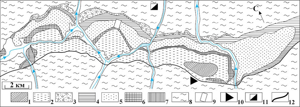
Background. The Fan-Yagnob syneclise is an imposed structure within the Hercynian Zeravshan-Gissar zone. It formed on a Paleozoic folded basement as series of sedimentary rocks from T3 to N1, including Jurassic, Cretaceous, and Paleogene terrigenous complexes with a total thickness of ~ 2.7 km. The syneclise hosts the Fan-Yagnob coal-mining field. In the vicinity, there are two deposits within the Paleozoic frame: the Takfon tungsten deposit with high concentrations of Sn, As, Bi, Cu, Ag, Au in the north and the Dzhizhikrut antimony deposit with Au, Ag, Hg, Tl, Se, Pb, Bi, Sn in the south. Previous geological prospecting within the Zeravshan-G issar zone of Central Tajikistan indicated that the Fan-Y agnob syneclise had limited potential for ore mineralization. This conclusion was based on the absence of magmatism and hydrothermal processes in its contours. In 2024, we carried out a study of the Jurassic terrigenous stratum, including its mineralogy and geochemistry, which calls into question the presumed absence of ore mineralization within the syneclise. Exploration works were conducted along the watershed between the Yagnob and Fandarya rivers, at Mount Kuhi-Malik, above zones of gas emissions associated with known coal fires. At this site, the Jurassic sandstone sequence, with a thickness of approximately 800 m, was investigated. Samples were collected from all lithological varieties of the terrigenous rocks.

Aim. To assess the metalliferous prospects of the Jurassic terrigenous rocks of the Fan-Yagnob syneclise.

Research object. The Jurassic sedimentary clastic rocks of the Fan-Yagnob syneclise.

Materials and methods. From the most complete section of the Jurassic system located on the watershed of the Yagnob and Fandarya rivers, 26 specimens, each weighing 1.5 kg, were collected from all rock varieties. These specimens were used to prepare polished thin sections, polished grain mounts, and geochemical samples. Analysis was carried out using a portable X-ray fluorescence (XRF) spectrometer Vanta-M  (Olympus, USA); X-ray tube anode: Rh, tube power 4 W, voltage 50 kV, SSD detector. The composition of heavy mineral grains and their semi-quantitative analysis were conducted using a JSM-840 scanning electron microscope (JEOL) equipped with a Si(Li) semiconductor detector and an INCA-350 analytical system (Oxford Instruments) at an accelerating voltage of 20 kV and a beam current of 2 nA. The elemental composition of the rocks was determined by emission spectroscopy and mass spectrometry using inductively coupled plasma (ICP) spectrometers. For analysis, the samples were divided into two types: easily and hardly decomposable. The former were dissolved using a Hot Block system, while the latter were brought into solution using the same acid mixture in microwave autoclaves (MARS-5). Element concentrations were measured using an ICP-OES VARIAN-720 spectrometer and an HP 4500 series mass spectrometer. Multi-element standards from MERCK and SPEC were used as calibration standards. All analytical work was carried out at the A.E. Fersman Mineralogical Museum of the Russian Academy of Sciences (analysts L.A. Pautov and M. Saymudasiri) and at a laboratory of the Russian State Geological Prospecting University (MGRI-RSGPU) named after Sergo Ordzhonikidze (analyst M. Saymudasiri).

Results. In the terrigenous rocks of the Jurassic system, along an 800 m profile, anomalously high concentrations of V, Zn, Ce, As, Co, Eu, Se, Sb, Sm, Cd, and Ag were identified, exceeding Clarke values by three or more times. Along the geochemical profile, ore minerals containing the above- mentioned elements were identified, including stibnite, galena, argentite, native gold, and silver, as well as monazite-(Ce), xenotime-(Y), and florencite-(Ce). In addition, unidentified phases enriched in Se, Ta, Ni, Mo, Bi, Tl, Pb, Ge, F, Sn, and W were found.

Conclusion. The identification of Ag-, Pb-, Sb-, Sn-, W-, and Au-bearing ore minerals within Jurassic terrigenous rocks along an 800 m profile, occurring over extended intervals (tens of meters) within the geochemical anomaly characterized by V, Co, Zn, Ge, As, Sc, Ag, Cd, Sb, Ce, Sm, and Eu, suggests a possible manifestation of ore mineralization. This finding highlights the need for further investigation of the entire Mesozoic sedimentary succession of the syneclise, where ancient placer-type accumulations of certain metals may be present. Most of the detected ore minerals are extremely fine-grained, typically less than 40 microns, which likely explains why they were not identified in previous explorations. These results raise the question of the metallogenic potential of the Fan-Yagnob syneclise and possibly other Mesozoic syneclises in Central Tajikistan, warranting more detailed studies across the Jurassic formations.

GEOLOGY AND PROSPECTING FOR HYDROCARBON RESERVES
79-89 133
Abstract

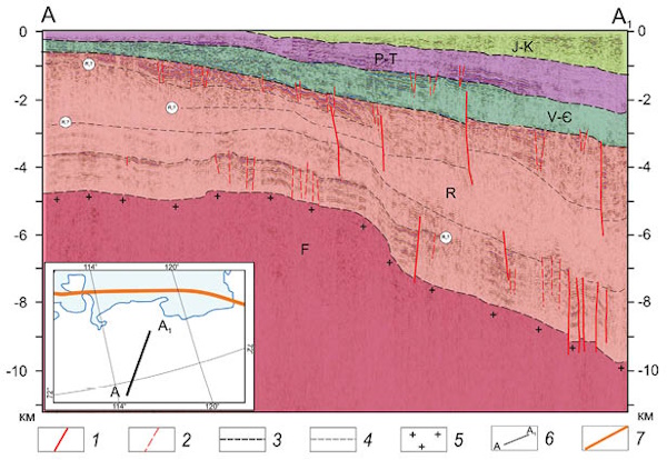
Background. The Anabar- Lena marginal system exhibits conditions favorable for the hydrocarbon prospectivity of Riphean sedimentary deposits. In this regard, the question about the presence of a sufficiently rich oil-and-gas source to form hydrocarbon deposits here is most acute. Poor knowledge of the Precambrian part of the section prevents using more accurate methods for estimating the volume of hydrocarbons generated and expelled from the source rocks. In this case, a probabilistic volumetric-g enetic analysis is appropriate for estimating the range of hydrocarbon volumes that could be generated by organic-rich deposits.

Aim. To estimate the magnitude of generation and expulsion of liquid and gaseous hydrocarbons from the Mukun and Billiakh series, as well as the Riphean Khastakh formation.

Materials and methods. The probabilistic estimate of hydrocarbons generated and expelled from the source rocks of the Anabar-L ena marginal system was performed using the volumetric-genetic  method.

Results. In total, the Riphean source rocks of the northern marginal system of the Siberian Platform could have generated about 33.1–86.5 billion t of oil and 57.7–174.2 trillion m3 of gas.

Conclusion. The performed analysis suggests that the Riphean source rocks may have generated a significant volume of hydrocarbons capable of forming oil-and-gas accumulations. In this regard, the most relevant and controversial issue may be the assessment of hydrocarbon preservation in traps, i. e., sites of their final expulsion, as well as and the methodology for their detection.

90-98 85
Abstract

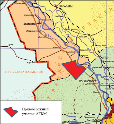
Background. The subsalt Lower Permian rocks in the southern Pre-Caspian Basin are recognized as a primary target for further hydrocarbon exploration (Voronin et al., 1991; Fedorova and Bystrova, 2010; Babasheva et al.; 2023; Merkulov et al.; 2023, 2024). Their considerable potential is evidenced by numerous oil and gas shows and commercial hydrocarbon inflows from the Lower Permian Filippovsky sediments, identified in wells within the Astrakhan Arch and adjacent areas of the Astrakhan-Kalmyk sector of the Pre-Caspian Basin. However, the development of this succession is complicated by active salt tectonics. Conventional seismic interpretation techniques are insufficient for resolving the internal structure of these formations or constructing reliable geological models. These challenges can be addressed through the application of full-volume seismic interpretation, one of the most advanced methods for constructing geological models of complex subsurface areas.

Aim. To construct a geological model of the Lower Permian subsalt deposits within the Right-Bank sector of the Astrakhan Gas Condensate Field (AGCF) and to evaluate their hydrocarbon potential using full-volume seismic interpretation technology.

Materials and methods. Geological modelling of the Pravoberezhny section of the AGCF was conducted based on the results of 3D common depth point seismic surveys covering 800 km2, well log data on the study area, and published materials on the geological structure and development of the sedimentary cover in the southern Pre-Caspian Basin.

Results. A geological model of the Lower Permian subsalt deposits in the Pravoberezhny section of the AGCF was developed. Large anticline-type objects recommended for further study were identified.

HYDROGEOLOGY AND ENGINEERING GEOLOGY
99-108 80
Abstract

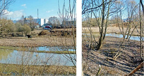
Background. This article presents an analysis of data on landslide processes observed in the Moscow Oblast (Russia). Key factors in the formation and activation of the landslide slope, which determines the development and spreading of landslide processes, are considered.

Aim. To identify the key factors and conditions contributing to the development and activation of landslide processes in the Moscow Oblast, and to characterize their types depending on lithological and stratigraphic complexes.

Materials and methods. The morphological analysis of landslide processes included the study of their main parameters, such as the configuration of the landslide body in plan, the depth and steepness of the slopes, the mechanisms of rock displacement, and the height of the collapse wall. A comparative geomorphological analysis aimed at identifying common patterns and regional features of landslide processes in different geographical areas and on different types of slopes was conducted.

Results. The main patterns of landslide distribution depending on lithological and stratigraphic characteristics and geomorphological conditions were considered.

Conclusion. Three main lithological and stratigraphic complexes, which are subject to landslide processes, have been identified: Quaternary sandy–clay deposits, Jurassic clays (Oxfordian stage), and carbonate rocks with clay interlayers. Each of these types has its own characteristics, including the type of displacement, the depth of slope capture, and the causes of emergence.

109-118 82
Abstract

Background. Acquiring popularity in global design and construction practice, stochastic approaches are actively used in geotechnical applications. These approaches take into account the uncertainty associated with the variability in the physical and mechanical properties of soils due to their heterogeneity.

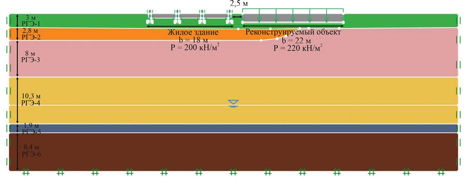
Aim. To consider the application of a stochastic approach, taking into account the linear change in the total deformation modulus of base soils over the depth of compressible stratum, determined according to Terzaghi [13], for assessing the area of impact of the reconstructed facility on the surrounding development.

Materials and methods. The combination of random finite element method (RFEM) with the linear change in the total deformation modulus over the depth of compressible stratum takes into account spatial variability of soil properties, as well as predicts the occurrence of deformations. The depth of compressible stratum was determined according to Terzaghi in order to calculate the final settlement of the base [13]. The study was conducted using the example of a reconstructed facility in Moscow, Russian Federation. During the reconstruction, the load on base soils was increased.

Results. A comparison of the conventional calculation method and RFEM showed that the residential building is out of the impact area in both cases. However, significant differences were observed in the total deformation (final settlement) of the base, depending on the calculation method. In addition, the probability of exceeding the set value of total deformation was assessed using the stochastic approach.

Conclusion. The results of the work indicate the need to implement a stochastic approach in contemporary design practices along with enhancing the method for determining the depth of compressible stratum and taking into account the increase in the total deformation modulus over the depth for improving the reliability and efficiency of design decisions.

119-127 84
Abstract

Background. In recent years, the Republic of Guinea has experienced a significant growth in the construction and reconstruction of basic infrastructures, including Conakry International Airport, the Amaria and Kukutamba hydroelectric power stations, the port of Conakry among other essential facilities. This dynamic process necessitates regional engineering and geological research of lateritic weathering crusts in Guinea, as they serve as the foundation for most of the aforementioned structures.

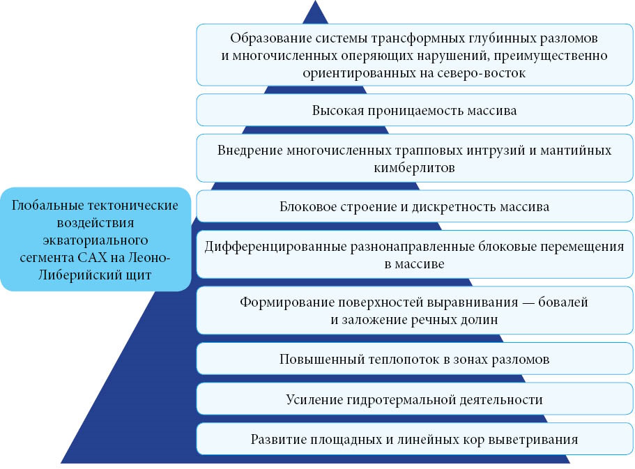
Aim. Development of the theoretical principles governing the development of engineering and geological lateritic formations and assessment of the influence of Mid-Atlantic rift geodynamics on the weathering crust of Guinea.

Materials and methods. Collection, analysis, and review of geological and geographical scientific publications, archival materials, and the authors’ field and laboratory data with the purpose of establishing the role of geodynamics in the formation of weathering crusts and their classification.

Results. A concept has been proposed to describe the influence of Atlantic rift geodynamics on the formation of Guinea’s lateritic bauxite-b earing weathering crust.

Conclusion. The proposed original concept elucidates the composition formation patterns, structural and textural features, and physical and mechanical properties of the engineering and geological formation of the lateritic weathering crust.

GEOLOGICAL EXPLORATION TECHNIQUE

128-138 92
Abstract

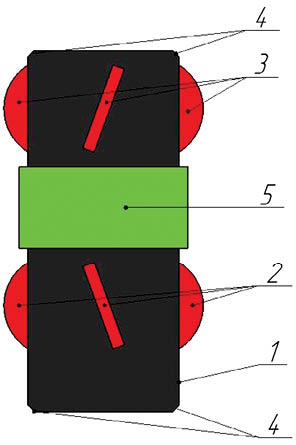
Background. Uranium mining by in-situ leaching (ISL) requires specialized methods for the construction and operation of process wells to ensure their reliable performance throughout the entire mining period of cells, blocks, and deposits. During operation, polymer production casing strings are subjected to various loads, among which thermal and hydrostatic loads are particularly significant. This article presents a calculation-b ased justification for the selection of well equipment and waterproofing materials for preventing violations of the integrity of production casing strings through the use of displacement centralizers, wellhead centralizers, and viscoelastic materials. Methods for determining the cementing (waterproofing) intervals and the permissible height for filling the annular space with bulk materials are presented.

Aim. To ensure the integrity of polymer production strings of process wells operated under variable temperature conditions during uranium mining by insitu leaching.

Materials and methods. Physical processes occurring during the construction and operation of process wells were analyzed. The effectiveness of available engineering solutions was compared based on the period of accident-free operation of polymer production strings.

Results. Effective engineering solutions proposed for equipping polymer production casing strings are those that provide the possibility of their linear movement in the axial direction at the stages of construction and operation of process wells.

Conclusion. The use of latest engineering solutions for equipping production strings makes it possible to mitigate the risk of accidents during the development of uranium deposits by in-situ leaching.

139-152 83
Abstract

Background. Ensuring industrial and environmental safety at mining enterprises requires the implementation of modern methods for monitoring ground surface deformation. Classical geodetic methods demonstrate limited effectiveness for continuous monitoring of extensive mining allotments, while remote sensing technologies, in particular Interferometric Synthetic Aperture Radar (InSAR), offer opportunities for creating proactive monitoring systems.

Aim. To carry out a comprehensive analysis of the methodological foundations, capabilities, limitations, and prospects of InSAR technology, the method of Small Baseline Subset (SBAS-InSAR) in particular, for solving problems of geodynamic and geotechnical monitoring at mining facilities.

Materials and methods. A systematic review of scientific publications and practical experience of applying InSAR at mining enterprises in Russia (Kuzbass), Kazakhstan, Australia, and China was carried out. A comparative analysis of DInSAR, PS-InSAR, and SBAS-InSAR technologies was conducted. The methods of mathematical modeling of deformation processes and economic efficiency assessment were used.

Results. The SBAS-InSAR method demonstrates the best balance of accuracy (1–3 mm/year), areal coverage, and resistance to decorrelation under conditions of mining landscapes. Key areas of application include monitoring of open-pit slope stability, controlling tailings dam integrity, and observing subsidence in undermined areas. The economic analysis confirmed that the implementation of InSAR can reduce capital and operational costs by 60–75 % while simultaneously increasing coverage area and data acquisition efficiency.

Conclusion. InSAR/SBAS-InSAR technology is a highly effective tool for transitioning from point- based to continuous monitoring of geotechnical risks. Its successful integration into the management systems of mining enterprises, especially in the Russian Federation, requires the adaptation of methodologies, development of a regulatory framework, and personnel training. Prospects are associated with the creation of hybrid systems that integrate InSAR data with ground-b ased sensor networks and artificial intelligence technologies.

Announcements

2025-02-17

Международная научно-практическая конференция «Новые идеи в науках о Земле»

Федеральное государственное бюджетное образовательное учреждение высшего образования «Российский государственный геологоразведочный университет имени Серго Орджоникидзе» (МГРИ) приглашает принять участие в XVII Международной научно-практической конференции «Новые идеи в науках о Земле».

Дата проведения конференции
03-04 апреля 2025 г.

Место проведения конференции
Россия. Москва, ул. Миклухо-Маклая, д. 23. , МГРИ
 
Мероприятие проводится при поддержке РАН и РАЕН с целью обобщения опыта, интеграции и систематизации теоретических и практических наработок в геологической отрасли, выработки новых технологических решений в процессах освоении недр.

В работе конференции планируют принять участие более 700 ученых и специалистов из регионов России и зарубежных стран.

По результатам конференции, доклады участников конференции будут размещены в электронной библиотеке научного цитирования (РИНЦ).

Участие в конференции бесплатное.

Окончание приёма тезисов докладов и заявок 01 марта 2025 г.

More Announcements...


Creative Commons License
This work is licensed under a Creative Commons Attribution 4.0 License.